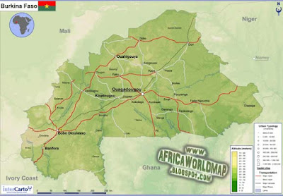
Burkina Faso World Map and Information
Burkina Faso World Map and Information
Burkina Faso was originally named Volta, after the river of the Red, White, and Black Volta gathered in the region. It is a country locked in the upper part of West Africa, bordering with Mali and Niger in the northwest and northeast receptively, and Cote d'Ivore, Togo, Benin, and Ghana in the south. The capital is Ouagadougou. Burkina Faso is a French protectorate was established in 1896. The protectorate became self-governing colony and its name was changed to Upper Volta on December 11, 1958. In 1960, it became an independent country and in 1984, changed its name to Burkina Faso, which means is the Land of the People Free '. Soldiers took office in 1970. The following is a Burkina Faso map that you can use for learning, study, or work.


0 Response to "Burkina Faso World Map and Information"
Post a Comment